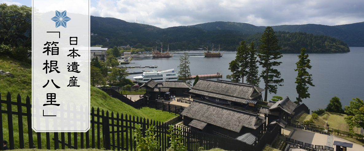


Japan Heritage, Hakone Hachiri
Infinite stone pavement conveying the footsteps
of travelers from the past
― Hakone Hachiri, the trace of a journey from the Edo period ―

Tokaido Hakone Hachiri is a pathway that crosses Mount Hakone, known for its steep slopes, which were even portrayed in a folk song.
Being one of the most important arterial roads dating from the Edo period (the 1600s to the mid-1800s), Hakone Hachiri boasted the grandest stone pavement in Japan to support heavy traffic of people.
The Hakone pathway conveys the footsteps of historic travelers, such as feudal lords visiting Edo (which later became Tokyo) from western Japan, directors of the Dutch Trading Post from Nagasaki, officials and diplomats in Joseon missions to Japan, and Tokugawa shogunate officials assigned to govern Nagasaki to oversee foreign relations. Along the Hakone Hachiri pathway are post towns, teahouses, an official checkpoint, roadside trees, and milestones that portray the landscape from the past and take visitors to the travel scenes of the Edo period.

Outline of Japan Heritage
Japan Heritage is aiming to preserve stories depicting Japanese culture and traditions through historical features found in different parts of Japan. Historically and culturally valuable stories are recognized by the Agency for Cultural Affairs. Japan has a variety of tangible and intangible cultural assets that are greatly attractive and essential aspects of depicting stories. The mission of Japan Heritage is to encourage and promote autonomous efforts of different regions to preserve and maintain these assets, to strategically transmit their information to people in and outside of Japan, and to revitalize regional economies.
The ancient Tokaido path, Hakone Hachiri, connecting Odawara City and Hakone Town of Kanagawa Prefecture, and Kannami Town and Mishima City of Shizuoka Prefecture, was recognized as Japan Heritage in May 2018 for its story of experiencing a journey in the Edo period.
Hakone Hachiri includes many cultural assets that collectively make up Japanese Heritage. This is the only place in Japan in which all of the essential features of a journey in the Edo period, including a castle town, post towns, stone pavement, roadside trees, teahouses, and official checkpoint, are present.
Outline of Hakone Hachiri
The ancient Hakone path, Hakone Hachiri, refers to a part of the Tokaido path that the Tokugawa shogunate constructed in the early Edo period. Specifically, Hakone Hachiri refers to about 32 kilometers of the path connecting the Odawara Post Town (altitude: about 10 meters above sea level) to the Hakone ridge (altitude: 846 meters) and down to the Mishima Post Town (altitude: about 25 meters).
This section of the path was known as the first difficult section that travelers from Edo encountered in their journeys. The tough journey along this section was also portrayed in a folk song. Among the path of the Hakone Hachiri, the section from the Mishima Post Town to the Hakone Official Checkpoint located after passing the Hakone ridge was called nishi-zaka, or the West Slope. The section from the checkpoint to the Odawara Post Town was called higashi-zaka, or the East Slope.
Along with the Sakawa River in Odawara, Mount Hakone was the most important geological feature that protected Edo, the headquarters of the Tokugawa shogunate, from its adversaries from the east.
Back in the Edo period, this steep path was filled with a stream of various travelers, such as the party of the Dutch East India Company on its missions to Edo, the march of the Joseon missions paying respectful visits to the Tokugawa shogunate, a group of Tokugawa shogunate officials heading to their assigned post in Nagasaki to oversee foreign relations, and commoners on worshipping trips to the Ise Grand Shrine in Mie or the Kompira Shrine in Shikoku.
The ground of the Hakone path was initially lined with bamboo to protect travelers from slipping. It later became a stone-paved path in 1680, when it was lined with stones at intervals of about 3.6 meters.
Among the milestones that still remain along Hakone Hachiri, Nishikida Milestone was designated as a national historic site in 1922.
In 2004, a total of 5.05 kilometers of the West Slope and East Slope became a national historic site.

